This BLM managed area is popular for off highway vehicles and mountain bikes. There are also many stone arches in the area for hikers to find and there is the cultural history of use by American Indians.
Trails in and near Arches National Park near Moab, Utah. Includes Delicate Arch, Corona Arch, Negro Bill Canyon, Landscape Arch, Double Arch and more. Trail Notes and Pictures of what to expect. Hike for fitness and awareness of the natural environment.
Saturday, April 18, 2009
Birthing Scene Petroglyphs
The Birthing Scene Petroglyph site is a large boulder located only 75 feet from Kane Creek Road in the rocky wilderness area west of Moab in southeast Utah. The site is 5.3 miles west of the junction with Road 500 West.
 There are petroglyphs on all four sides of the boulder with the birthing scene being the art work that captures the most attention. This site is a little unusual as the many of these sites are on cliff faces rather than boulders.
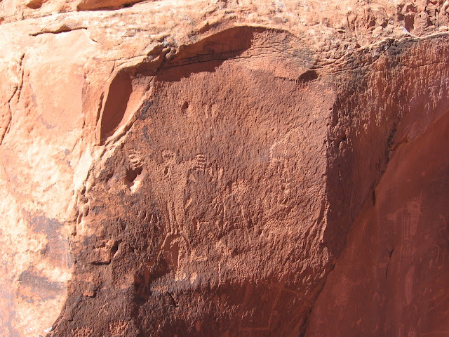 The road leading to the site runs along the south bank of the Colorado River, and then follows Kane Creek through a very rocky dry area.
This BLM managed area is popular for off highway vehicles and mountain bikes. There are also many stone arches in the area for hikers to find and there is the cultural history of use by American Indians.
This BLM managed area is popular for off highway vehicles and mountain bikes. There are also many stone arches in the area for hikers to find and there is the cultural history of use by American Indians.
Thursday, April 16, 2009
Moab Rim Trail
The Moab Rim Trail is a multi user trail route that climbs to the cliffs overlooking the west side of Moab in southeast Utah. It offers 3.5 miles of road before connecting with the Hidden Valley hiking trail which approaches from the south.
The Trailhead is well marked and is located on Kane Creek Road about 2.5 miles west of the junction with Highway 191.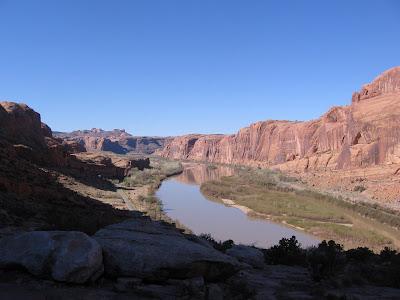 The trail climbs steeply in the first mile, gaining about 1000 feet. There are increasing spectacular views of the Colorado River as it winds toward the Canyonlands National Park. The trail is easy to follow as there are tire marks and oil spots on the Kayenta Sandstone.
The arch known as Little Arch is visible in the top of the cliffs on the opposite side of the Colorado River. Little Arch can be viewed from above along the Poison Spider Trail.
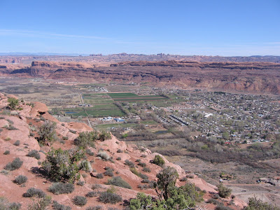 It took me about 30 minutes to get to the top where there are wide views overlooking Moab with some of the arches in Arches National Park visible and the La Sal Mountains to the east. There are some short trails to explore in the overlook area.
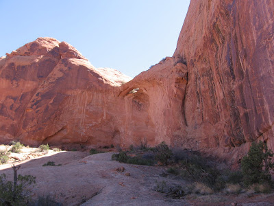 The trail cuts away from the rim and splits forming a loop. The left loop follows a sandy wash between large Navajo Sandstone domes and there is a small arch to the left. I think this one is called Buttress Arch. I spent a few minutes getting up under the arch for the blue sky angle, and then followed the right side of the loop.
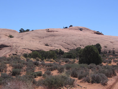 The route is a two track road for a while then climbs a dome that looked unbelievable to try to drive over. There are good views in all directions from the top of the rocky knob. After descending from the top, the sandy wash part of the loop connects and then the road splits again and ends.
 I turned back and followed the sandy part of the loop down a steep slope to explore a side canyon that had several alcoves. This looked like a likely place to find Indian Ruins. This was a scenic and narrow rocky area with some seep springs and lush vegetation but I didn’t see any ruins in the several alcoves.
From here I followed the sandy wash back toward the trail head. There may be ruins or petroglyphs on the road further along the road on the right fork.
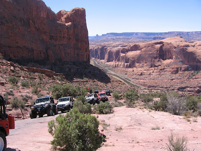 There was quite a bit of 4WD drive activity on the trail in this mild April afternoon, with traffic jams forming as the vehicles labored past the tricky spots on this difficult route. With my side trips, it took me 3:00 hours to get to my turn around point, but only 1:15 to return to the bottom for a total hike of 4:15.
The Trailhead is well marked and is located on Kane Creek Road about 2.5 miles west of the junction with Highway 191.
The arch known as Little Arch is visible in the top of the cliffs on the opposite side of the Colorado River. Little Arch can be viewed from above along the Poison Spider Trail.
From here I followed the sandy wash back toward the trail head. There may be ruins or petroglyphs on the road further along the road on the right fork.
Wednesday, April 15, 2009
Moab Golf Course Petroglyphs
The Moab Golf Course Petroglyphs are one of about seven easy to visit rock art sites in the area. The site is one mile east on Spanish Trail Road, leading toward the golf course, and then 0.5 miles on Westwater drive past a small traffic circle.  This site has some large figures that are sometimes referred to as Moab Man. This site is somewhat suburban compared to other rock art sites, with a nice housing area and the lush green golf course nearby.
I saw several groups of dirt bikes gearing up for a ride in the beautiful rock wilderness in the area. If you drive past the site, the road ends after a short distance at a 4WD road.
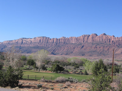 The golf course site is on the southeast side of Moab away from the Colorado River area where several of the other rock art sites are located. Across the valley to the west is the Moab Rims area, where there are rough trails and fabulous rock formations.
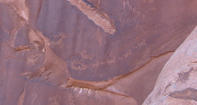 The panel is about 30 feet high and 90 feet long. Toward the right end is a group of figures that resembles a team of reindeer pulling a sleigh.
 This site has some large figures that are sometimes referred to as Moab Man. This site is somewhat suburban compared to other rock art sites, with a nice housing area and the lush green golf course nearby.
I saw several groups of dirt bikes gearing up for a ride in the beautiful rock wilderness in the area. If you drive past the site, the road ends after a short distance at a 4WD road.
 The panel is about 30 feet high and 90 feet long. Toward the right end is a group of figures that resembles a team of reindeer pulling a sleigh.
Subscribe to:
Posts (Atom)