Tuesday, June 21, 2011

Balcony Arch and Picture Frame Arch-Behind the Rocks

Balcony Arch and Picture Frame Arch are in the Behind the Rocks area south of Moab in southeast Utah. The access is a west turn on the BLM Behind the Rocks road at mile post 112.9 on Highway 191.

It is 5 miles west on the BLM road then about 0.2 miles north where a large sandstone rock mass is visible. It is possible to park right below the east facing Balcony Arch. The Behind the Rocks road has some bumpy rocky spots and might be sandy after a long dry period. The sand was firm and easily drivable with a Subaru during my visit, but travel is slow.

There is a system of marked side trails in this area for off highway vehicles and mountain biking. There is also an effort to restrict vehicles and camping to designated areas to restore the desert vegetation. Looking back to the east, there are good views toward the LaSal Mountains, still with snow in mid June.
 
It is only 10 minutes of walking to the north side of the same rock mass where Picture Frame Arch can be found. The views to the north are toward the jumbled Behind the Rocks area. A few of the area designated camp sites are along the east side of the sandstone rock mass.
 
Picture Frame Arch is also in a vegetation damaged area and has signs asking for restricted travel in the area below the arch.
My total visit to Balcony Arch and Picture Frame Arch took 30 minutes including about 20 minutes of walking.

18407_$5 Shipping on Orders of $99 or More!

Tuesday, April 12, 2011

Hunter Canyon Rim Trail

The Hunter Canyon Rim Trail begins at the east end of the Spring Campground, 6.9 miles west from Highway 191 along Kane Creek Road near Moab in southeast Utah. This is about 0.5 miles before the better known Hunter Canyon Trail.

The trailhead isn’t marked and the first segment is confusing, even the first steps are confusing. I started by walking up some steps and then through a campsite on the right side of the creek. The trail crosses the creek and heads up along the left side of a narrow canyon with a pour off point about 300 yards ahead. There is some rock scrambling up to the left to get above the pour off. The route is marked with rock cairns, but I had to look carefully to follow them.

I got confused at the pour off. The main trail circles the pour off and makes a 180 degree turn, then climbing with a view above the campground area. There are also side trails and rock cairns that continue up the canyon. I spent an hour looking for the trail up the canyon before deciding that I was off the track.
 
Once past the pour off, the trail is easy to follow. There are views of the trailhead area for Hunter Canyon as the trail climbs.

 From above, the meanders of Hunter Canyon are visible as is the large Hunter Arch. The views of Hunter Arch continue for most of this segment. The closest views of Hunter Arch are an end on angle, without much of the opening visible. After about 1.5 miles, the single track trail becomes a 4WD trail.


 A short distance along the 4WD segment, there is a junction with a side road leading up a side canyon toward an alcove. At the junction, there might also be a view of the top of the Halls Bridge Arch.


In the alcove, there is a small ruins site. The main structure still intact looks like a granary storage site. There is other rubble and a circular depression in the alcove, but not much else is intact. In the Arches and Canyonlands area, there is a lot of rock art, but not many ruins structures. It took about 0:15 minutes to walk the side trail to the ruins site and my total time on this segment was 0:40 minutes.
 
From the ruins trail junction, my return hike took 1:25 hours. Hiking the final descent was as confusing as the start. My total hike took 4:40 hours counting 1:00 hour off the track for about 4 miles. On a sunny mid April day it was 48 F degrees at 9:45 AM and 66 F degrees 2:25 PM. I carried 3 liters of water and drank most of it.


Thursday, March 10, 2011

Sevenmile Rim and Uranium Arch

The access for the Sevenmile Rim Trail can be found 0.6 miles north of Highway 313, north of Moab in southeast Utah. Highway 313 is the route to the Island of the Sky District of Canyonlands National Park. From the large gravel area, I continued 2 miles north on the Cotter Mine gravel road to the trailhead sign and started hiking there.

The overall Sevenmile Rim Trail is about 20 miles for off road vehicles. Uranium Arch can be reached after about 3.5 miles of hiking. The first part of the route switchbacks up to the mesa top and the rim area. There are many side roads in this area and they are confusing. The main route is marked with small signs that say “7R”. After about 30 minutes of hiking I arrived on top at a 3 way junction, with both routes marked, and 7R stays to the left.

The terrain here is sandy and rocky with scattered Pinon Pines and Utah Junipers, Mormon Tea, Narrowleaf Yucca, Blackbrush, Cliff Rose, and Prickly Pear Cactus. There are views toward the LaSal Mountains to the east and the Merrimac and Monitor Buttes to the west. The walking is easy and there are obstacles for Jeeps and ATV riders. The route passes along the head of Corral Canyon and crosses a drainage and passes a mine site.

About 1 mile from Uranium Arch, BLM signs appear pointing the shortest easiest way to this large arch. Following the signs will be a detour off of the 7R trail but it is possible to loop back onto 7R. An interpretive sign at the arch site describes the geological processes that form the arch and mention that it is in the Kayenta Sandstone layer.

There is also a description of the Uranium mining history in the Sevenmile Rim area. Some fencing in the area is intended to protect the desert vegetation and Riding with Respect in emphasized. It took me about 1:30 hours to arrive at Uranium Arch.

A side branch from the 7R Trail is visible as painted white stripes that descend to the arch site from the right side of the formation. Uranium Arch can be viewed from both sides down below and can also be easily viewed from above.


It is worthwhile to follow striped route up and rejoin the 7R Trail for the spectacular views from the rim. The return hike continues to be confusing with the many side trails. My total hike took 3:20 hours for about 7 miles. I carried and drank 2 liters of water on a 56 F degree early March day. I saw one other hiker and 1 Jeep during my hike.


Tuesday, February 15, 2011

Willow Springs Trail and Leaping Arch

The Willow Springs 4WD road begins on the west side of the Arches National Park main road across from the parking area for Balanced Rock. 


The first 0.8 miles passes a small picnic area and is easily drivable. Beyond the picnic area there is a junction with the 4WD road that leads to Klondike Bluffs and both roads become much rougher.

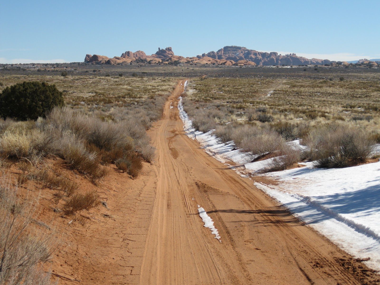
I started my hike at the junction and continued hiking west toward the Willow Springs area. The wide views straight ahead are toward the spectacular Moab Rim.

The views back toward the jumbled Balanced Rock area are also eye popping. To the north, there is a view of the south side of the Eye of the Whale Arch. The desert terrain here is mostly treeless with Mormon Tea, Blackbrush, Rabbitbrush, and grasses. The walking is easy on the dirt road. In mid February, there are small patches of snow.

It took me 1:15 hours to reach the park boundary sign. The sign where I started hiking said it was 4 miles to the boundary but it felt more like 3 miles. There is a large drainage near the park boundary that runs back to the northeast. I didn’t notice any flowing water or willows along the road, or any sign that identified the Willow Springs.
I turned and followed the drainage northeast back toward the large sandstone outcrops that include Eye of the Whale Arch and Leaping Arch. The hiking in the drainage was mostly easy on a wide swath of sand. There are a few pour over points that are easy to walk around. At the northwest corner of the rock formations I found a side drainage to follow east along the north of the rocks. There is a series of fins along here with Leaping Arch appearing in one of the fins.

It took me another 1:25 hours to find Leaping Arch, about 2 miles from the park boundary following the wide sandy drainage. Approaching from the west, Leaping Arch isn’t visible until you are nearly alongside it. It is possible to climb up closer and get a blue sky view from below.
 
Leaping Arch is only 0:15 minutes of hiking west of the Eye of the Whale Arch Trail, but it is not mentioned on the park map and there aren’t any signs pointing it out. Once you know to look for it, both arches are visible at the same time along the Klondike Bluffs 4WD road.
 
From Leaping Arch, it is about 2 miles along the Klondike Bluffs Road back to the junction. Near Leaping Arch, there are very good views of the snowy LaSal Mountains with the sandstone of Arches National Park in the foreground. My total hike following the loop route took 4:00 hours for about 7 miles. It was 38 F degrees when I started at about 11:00 AM and about 50 F at 3:00 when I finished on a mild mid February day.


Tuesday, December 14, 2010

Cameo Cliffs and One Eye Window

The Cameo Cliffs is a special BLM management area 30 miles south of Moab and 18 miles north of Monticello in southeast Utah. The area has about 50 miles of trails usable by ATVs and others on 15 well marked routes. These trails are mostly old mining and ranching routes and pass through a very scenic area of sandstone cliffs, canyons, and rounded domes.


I started at the Hook and Ladder staging area, an east turn on Steen Road off of Highway 191. There is also a sign at the turnoff saying OHV Trailhead. There are good maps of the area available at the trailhead published by the San Juan Public Entry and Access Rights (SPEAR) organization. From the trailhead area, Trail 1 starts to the east and reaches a junction with Trail 2 after about 15 minutes of hiking.

I stayed on Trail 1 as it turned north toward the Cameo Cliffs. The trails I walked on are slightly sandy narrow roads. It took me 0:50 minutes of hiking to get to the Junction with Trail 3 that circles around the south and west side of the Cameo Cliffs.
 
The south side of the cliffs has a large cove that Trail 3 circles into and around. The habitat here is scattered Utah Juniper and Pinon Pines with grasses and sagebrush, Mormon Tea, Prickly Pear cactus and other desert shrubs.


On the west side of the Cameo Cliffs there is another cove area. Along the cliff face there are several alcoves that look like arches are forming. A short distance north of the cove area there is a large alcove where an arch has formed. I think this one is known as One Eye Window.

It took me 2:25 hours of hiking to arrive at the One Eye Window. There is another old road that is not part of the marked trail system visible to the west near the arch that would allow an alternate return route for a hiker. I decided to continue north to the next trail junction with Trail 9 and complete the loop around the Cameo Cliffs.
 
The Trail 9 segment is 2 miles east and west along an area called the Cameo Terrace. The views here are north across a very scenic valley of sandstone outcrops with the LaSal Mountains in the distance. I saw a very large monolith fin near the base of the cliffs in the distance. This spectacular area is also part of the trail system. The map shows routes going to the top of the distant cliffs and on to a view point of the roadside Wilson Arch.

Trail 9 makes a junction with Trail 1 that leads back to the Hook and Ladder Trailhead in 3 miles. My total hike took 4:50 hours for about 10 miles. I hiked on a very mild 54 F degree mid December day. On the day I hiked, I didn’t see any other visitors to the area.


528614_Russell Outdoor Logo 125x125 18407_$5 Shipping on Orders of $99 or More! 544544_$20 off any hotel booking of $350 or more with code TLSALE20