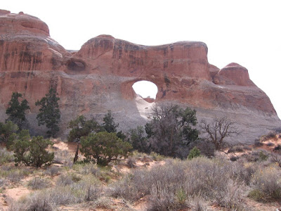
The Devils Garden Trail is one of the most popular trails in Arches National Park, near Moab in southeast Utah. The Devils Garden Trail Head is at the north end of the paved road, about 18 miles from the Visitor Center. It offers views of several large and well known arches without a lot of hiking.
A short distance along the smooth first segment of the Devil's Garden Trail leading to Landscape Arch is a side trail that splits with branches to Tunnel Arch and Pine Tree Arch.
The split to the right leads to Tunnel Arch which seems to actually be two arches, a smaller one forming, but with no light at the end of the smaller tunnel.
The left leading branch leads to Pine Tree Arch, one that you can go stand under if you dare.
It is only 0.9 miles total along the flat and groomed trail to 306 feet long Landscape Arch, the one featured on the park brochure and one of the world's longest natural stone spans.
The trail used to go up underneath until in 1991 a large section broke free and crashed to the ground. Now the views are from a distance. It is cited as an example that the arches are still developing and eroding, adding to the excitement of a visit.
There is a fracture line in Landscape Arch running parallel to the underside of the arch. Cracks like this are part of the process of exfoliation, the peeling off of layers of rock. This process is responsible for nearly all the arches in the park.
Someone happened to catch the breaking section of Landscape Arch on film and it was part of the 15 minute orientation film shown in the Visitor Center. The crack was described as being like a bolt of lightning striking. The new Visitor Center opened in September 2005. After Landscape Arch the trail becomes more primitive.
The next arch location is the now famous Wall Arch. On August 4, 2008 this large arch collapsed during the night. This is at least the third arch known to have changed when observers were around to notice. Beside Wall and Landscape, the nearby Skyline Arch lost a large section in 1940. After the Wall Arch collapse, the trail was re-routed slightly to avoid the area where it is feared that more collapse can occur. I noticed that the Wall Arch site has been deleted from the Devils Garden Trail Guide.
Back on the main trail and continuing on past the Landscape Arch, there is an 0.8 mile side trail to Navajo Arch and Partition Arch. Approaching Landscape Arch, the Partition Arch is visible above and to the right.
After the turn onto the side trail, there is a junction with Partition Arch to the left and Navajo Arch to the right. The Partition Arch is a double arch with views back over the area where you hiked. You can pass through the opening and find a shady alcove to relax in with a spectacular view.
The Navajo Arch is in the wall of rocks behind Partition Arch and doesn't have as good a view. It is easy to walk under with a smooth sand surface below, but there is only a narrow enclosed area on the back side. Returning to the main trail it is another 0.9 miles to the Double O Arch. The round trip to Double O Arch and back is about 4.2 miles. Add 0.8 miles with the side trip to Partition and Navajo and 0.5 miles with the side trail to Tunnel Arch and Pine Tree Arch.
There is a long section where the trail is more like those found in nearby Canyonlands National Park with some scrambling over and between rock fins with some spectacular views. The nearby La Sal Mountains form a back drop for many of the famous views in Arches Park.
As the trail approaches the Double O Arch, there is an overlook for Black Arch. Black Arch is always in shadows.
The one way distance to Double O Arch is about 2.1 miles without the side trails. Many hikers turn around here and follow the same route back. There is also a side trail at Double O Arch to the pinnacle called Dark Angel. The trail also continues on the Primitive Loop for a total tour of 5.9 miles.
(There are separate posts for the Dark Angel side trail and the Primitive Loop trail.)


No comments:
Post a Comment