 The first part of the trail climbs giving a view of the Colorado River as it snakes toward Canyonlands National Park. There is a train track, built in 1964, from the potash mining site that crosses the trail and is visible again toward the end of the trail.
 As the 440 feet of elevation gain continues, Pinto Arch is visible across the canyon. It is not easy to see as there is a rock background through the arch. There are also alcoves, and perhaps future arches forming high along the cliffs.
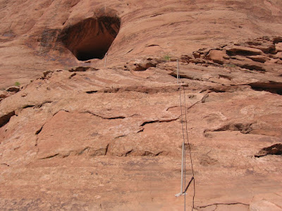
  There are three climbing aids along the trail. This one has some foot holds carved into the rock besides the cable to grab on to. There is also a small ladder further on.
 The spectacular Corona Arch comes into view. The trail head information says that the opening is 140 feet long by 105 feet high. It also mentions that Corona Arch is also sometimes called Little Rainbow Bridge.
 Just to the left of Corona Arch is Bowtie Arch, which appears to be a pothole type of arch, or one that eroded from the top down.
 It is possible to pass under the span and cross to the other side. I walked this trail in late August 2008 in the morning with the temperature about 85 F. It was warm but there was some breeze and it wasn't too bad.
It took me 1:20 hours to make the round trip. There were only two others hiking at the time I did.
No comments:
Post a Comment